Mapping Home
Tuesday 30th March, 2021
By Jacqueline Waldock
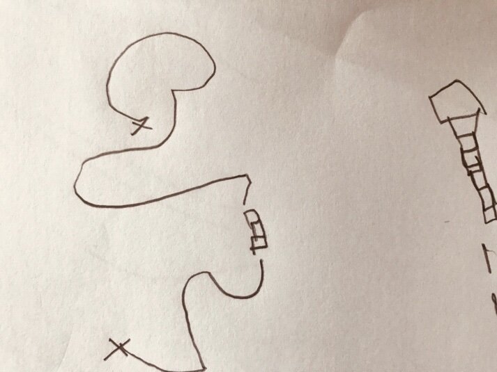
Image of a directional map, to find the secret chocolate - Drawn by a child
“More precious, though, are the unpublished maps we make ourselves, of our city, our place, our daily world, our life; those maps of our private world we use every day;…”
Alexander Mccall Smith “Love Over Scotland”
For many of us we think of maps as directional, or we think of Ordnance Survey maps. Perhaps for some of us our minds are drawn to the maps of imaginary worlds, such as Tolkien’s famous hand drawn annotated map of Middle Earth. However, maps are not only representations of spaces or directional guides; they are “condensed histories” (Ingold, T 2000:219), and deeply political, personal and sometimes emotional etchings, that allow for a representation of the world as perceived by the map maker.
In 2016 I created the project, Hand Drawn Histories, with the group 42nd street. The work collected hundreds of hand drawn maps from across Ancoats, Manchester. One particular map stood out for me, drawn by an elderly participant who had recently moved back to the area having grown up in Ancoats. He felt disconnected and disassociated with the spaces around him. New flats stood where factories had been, churches were now coffee shops and rehearsal spaces. On his map he didn’t draw what existed now but rather the “sweet memories” of what had been: the church where he had married his wife, the doorway where they had shared their first kiss. His map, drawn with a slightly shaky hand, beautifully captured his relationship with spaces that had, over time, disappeared, but now would be experienced once more in his sketching.

Image of a street map drawn onto skin, Hand Drawn Histories, Artist Waldock, J. 2016
English artist, Christian Nold, in his work “Emotion Map” (2007) represents the geographical space through bio-mapping and participatory comments from volunteers. The map highlights the emotional responses we have to spaces in our lived environments.

Image of San Francisco Emotion Map Artist Christian Nold
Other artists such as Jan Rothhuizen use hand drawn maps extensively in their work. His project “The Soft Atlas Dutch” is a series of part drawn, part written maps created in 2014. His detailed drawings are often deeply political and capture the personal intricacies of spaces, highlighting the detail with written descriptions. The series includes a map of a room at the Schiphol detention centre in Holland.
Philadelphia based artist, Kris Harzinski, captured the variety of ways in which people draw and understand maps in his archive “The Hand Drawn Map Association”. In 2008 Karinski started to collect personal directional maps drawn on napkins, the backs of envelopes and scraps of paper. Over time the archive collected not only directional maps but also what Karinksi refers to as “found maps, fictional maps, artful maps, maps of unusual places and explanatory maps” (2010:6). The collection includes maps of “childhood” and a “childhood fort”, sketches drawn for visitors to find coffee and drawings that represent the inside of a teenager’s locker.
The Mapping Home strand of the ‘Stay Home’ project is asking children and young people to draw a map of home. By asking them to express these spaces on paper, we hope to gain a better understanding of how their experience of the home space may have changed during the COVID-19 restrictions. The maps act as a tool for supporting children and young people in sharing knowledge of their unique experiential expertise of COVID-19 onto paper.
The impacts of the COVID-19 restrictions have been felt across age groups and sectors. Children and young people have had their daily lives radically changed. Their education and social activity have become centred around the home and their freedom to play outside, explore spaces and connect with friends has been restricted in a way never seen before. How have young people adapted to these changes? How have they sought out or created new spaces in light of these restrictions? How will they choose to express them?
Maps represent a vehicle for communication at a time of crisis. Drawing a map allows for the creation of knowledge around place and enables the voices of children and young people to be heard. In the broadest sense, we are encouraging children and young people to produce maps which are drawings or depictions that emphasise relationships between different elements of the home space, including rooms and objects and shared spaces. We are also encouraging written annotation to show how the use of the home space may have changed during COVID restrictions and are keen to receive maps that explore the sensory experiences of home as well as the human and physical geography of our home spaces; that show and/ or include experiences of outdoor as well as indoor spaces. All of the maps will become part of an online exhibition hosted by the Royal Geographical Society with IBG.
The map making will take place in schools as part of the wider curriculum. This not only allows students to develop their knowledge of map making but creates an important opportunity for pupils to map together, share their experiences and talk about the way in which COVID-19 has impacted on their lives. The creative nature of mapping allows for a freedom for them to think through and process the changes of the past year. If your school would like to take part in the project, please contact us on http://www.rgs.org/stayhome or jacqueline.waldock@liverpool.ac.uk.
“The maps will provide an extraordinary resource to educators, amongst others, to understand children’s experiences and to support their learning about those experiences and their preparation for an uncertain future.” Catherine Souch, RGS-IBG.
Reference
Ingold, T. The Perceptions of the Environment, Routledge Press 2000
Karinski, K. From here to there: a curious collection from the hand drawn map association. Princeton, Architectural Press, New York, 2010.